Eskdalemuir Magnetic Observatory
| Name | Eskdalemuir |
|---|---|
| IAGA code | ESK |
| Location | Eskdalemuir, Dumfries and Galloway, Scotland, United Kingdom |
| Latitude | 55.314° N |
| Longitude | 356.794° E |
| Elevation | 245m |
| Geomagnetic Latitude | 52.027° N |
| Geomagnetic Longitude | 75.258° E |
| Orientation | HDZF |
| In Operation since: | 1908 |
| INTERMAGNET member since: | 1991 |
Quasi-dipole geomagnetic coordinates are approximations calculated using the 14th generation IGRF at epoch 2026.5.
Background
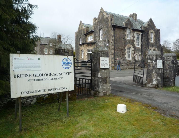
Eskdalemuir Observatory is situated in the Southern Uplands of Scotland. It is on a rising shoulder of open moorland in the upper part of the valley of the river White Esk. It is surrounded by young conifer forests with hills rising to nearly 700 m to the NW. The observatory is 100 km from Edinburgh and 25 km from the towns of Langholm and Lockerbie.
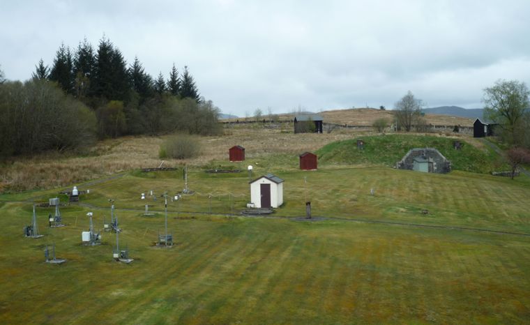
Eskdalemuir is a synoptic meteorological station involved in measurement of solar radiation, levels of atmospheric pollution, and in chemical sampling. The observatory operates a US standard seismograph and an International Deployment Accelerometer Program long-period sensor. BGS has a broadband three-component seismometer set installed at the observatory and records data from four remote sites transmitted to the observatory by radio link.
The observatory opened in 1908. It was built because of disruption to geomagnetic measurements at Kew Observatory following the advent of electric tramcars at the beginning of the 20th century. BGS took over responsibility for magnetic observations from the Meteorological Office in 1968.
There is one BGS staff member stationed at the observatory.
Eskdalemuir magnetic observatory is part of the INTERMAGNET network.
New measurements, new research
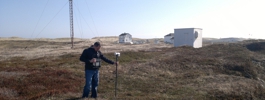
In June 2012 two high frequency (100 Hz) induction coil magnetometers were installed at Eskdalemuir.
In November 2012
two electrode pairs were installed to measure the geo-electric field.
Collaboration
Eskdalemuir is an ideal remote sensing location for many physical observations. We host a number of instruments for collaborators including:
- Met Office - meteorological observations
- University of Nottingham - High precision GPS for long-term ground movement monitoring
- University of Bath - Induction Coil Magnetometers
- University of Reading - Atmospheric Electric Field Monitoring
- British Antarctic Survey - VLF Radio Wave Detection
- Proudman Oceanographic Laboratory - Absolute Gravity Reference Station
- IRIS/IDA, University of California San Diego - Seismic Monitoring
- Ordnance Survey - GPS Reference Station
WMO Centennial Observing Station status
In 2019 the World Meteorological Organisation (WMO) awarded Eskdalemuir Observatory a Centennial Observing Station status. The WMO reconsides stations that provide long-term, high-quality climate records. These records help inform current and future generations about climate variability and trends and this new status will go some way to ensure the long-term sustainability of these measurements.
Video tour
Data
- Current K-index activity level
- Monthly Bulletin Archive
- Annual Means
- Hourly Means
- K-indices
- Daily local geomagnetic activity forecast
- Minute and Hourly Means (from World Data Centre)
- Yearbooks
- Geo-electric data
Articles
- Paper - Resolving issues concerning Eskdalemuir geomagnetic hourly values (2011)
- NERC Planet Earth - One hundred years at Eskdalemuir (2004)